London Dock Proposals (with photos)
A few crafty camera phone snaps of some of the initial designs for the 'London Dock' Development
UPDATE: See this new post for better quality diagrams and photos.
Tonight I attended, for the second time, a design workshop for the old News International site. I arrived at 6.15ish and left at 9.30ish. Of the three hours I was there, it felt like an inordinate amount of time was allowed for questions. Whilst I support the need for community engagement, anyone who has ever attended a lecture knows that questions inevitablty fall into three types: sensible pertinent questions, questions which are merely intended to state the questioners view or demonstrate their superior knowledge and questions which are actually based on at least three questions on different topics. I can't help feeling that there was a lack of the first.
What a consultation process like this really needs is good time management and strong facillitation. The moment you hear 'one more question' more than twice, you know it's not going well. I'm a strong believer in letting people ask questions, but sometimes, they people don't know when to stop and a small number of individuals dominate discussion. I admit to a loud sigh when someone asked about what species of trees would be planted and how deep their roots would be - clearly this would be the priority of the architects.
As a result, a lot of the time planned for discussions in our respective table groups (which were really interesting last time) ended up being devoted to incredibly detailed questions about a plan which is far from complete.
However, I'm sure that I'm in a minority, so I'll stop whinging.
We were given two presentations, on the types of buildings and the grouping of buildings and open spaces and the structure of the development.
Some key points revealed:
- Development of site to take ten years, with blocks built in phases dependent on sales (with the hint that if flats don't sell, progress would take longer, as sales finance the next phase)
- c.1500 flats on the site
- Two east-west pedestrian routes
- Public squares/spaces in the four corners
- Northern pedestrian route running south of Rum warehouse, with a waterway running down the middle with a number of bridges, with commercial/restaurant units focussed on lower levels along this route, and by Tobacco dock and the Vaughan Way end of the site.
- Working towards designing access through the Rum Warehouse north-south, by opening up archways, linking the site to Pennington Street.
- A number of blocks, primarily rectangular in shape running north south, with a number of landscaped open areas between the blocks with private courtyard type open spaces contained within the buildings
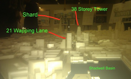
- Buildings in a variety of 'typologies' - most blocks seemed to be upto 15 floors, though one tower of 38 storeys
- The second east-west route running immediately north of Quay 430 linked to the northern pedestrian route via the 'gardens' running north-south
- Access to the site from the Highway, the ornamental canal and two entrances from Vaughan Way as well as potentially through Rum Warehouse from Pennington Street. I wasn't sure if there was an extra entrance by Tobacco Dock on Pennington Street, and if this requires any demolition work.
- Underground carparking with undefined number of spaces (they are in dispute with LBTH on this but didn't refer to this)
- Only vehicle access would be taxi drop off and delivery access. Waiting for traffic study to decide on where access is from.
- A large open space to the south west corner - a reference was made to having a space suitable for housing a temporary ice rink.
- No planned space allocated to a high school or specifically for other community spaces, but subject to LBTH.
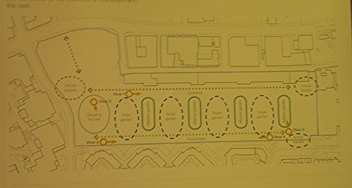
Plan of the site - the water gardens are intended for access only by residents, the market gardens open to the public. The gauging square, south west corner would be the 'ice rink' site.
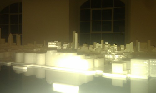
View of the model, with an attempt to capture perspective from the river - note the 38 storey tower
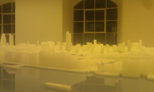
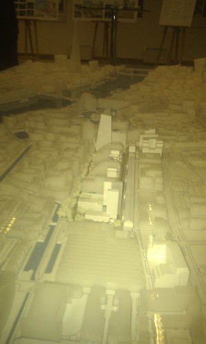
'Aerial' view of the model - note the difference in height of the buildings relative to the rest of Wapping
A large number of the buildings are stepped, increasing in height towards the north - you can see the 300m long rum warehouse running as a spine top to bottom
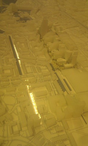
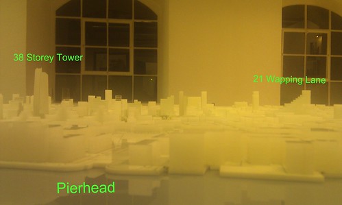
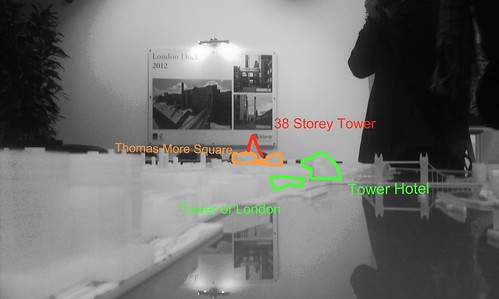
View from the East- apologies for amateur labelling!
Annotated view from the river- note the height of the new tower
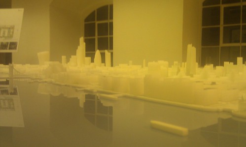
View from London Bridge (this is a protected view)


Comments
Post a Comment
Please leave a comment to let me know if you think I've got it totally or partially wrong!